
 Trout Times
News of interest to the Colorado angler
from various sources including
the Division of Wildlife and Denver Water. Plus fishing events of note throughout Colorado
Headline News -
- Zebra and Quagga Mussels and Boating:
- Info from CO Parks and Wildlife on mandatory boat inspections Click here
- Upper portion of Arkansas River is now Gold Medal - see this page
- Check Snowpack Levels
Headline News - Water Supply - Streamflows
Check streamflow for individual river segments HERE
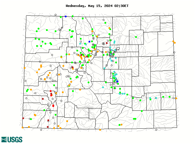
Check streamflow for river segments via map - Click Here - summary map shown below
|
|
| This map of the state of Colorado shows streamflows in real-time relative to long-term annual average streamflows for each reported station. It is a quick graphic way to see how current streamflows compare to averages for this time of year. Map produced and provided by the USGS | |
|
|
|
|
|
|
|
|
|
|
|
|
|
|
|
|
|
|
|
|
|
|
|